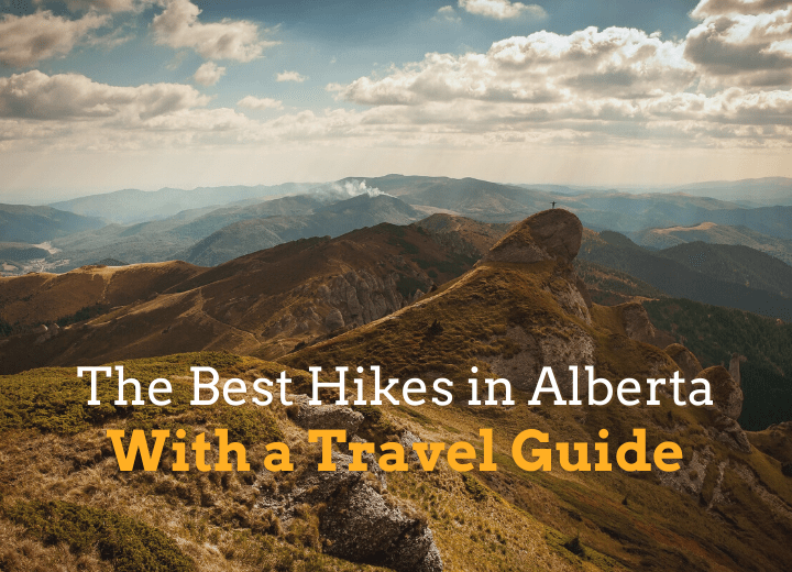
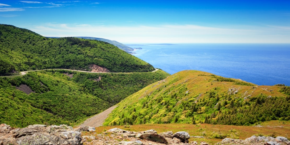
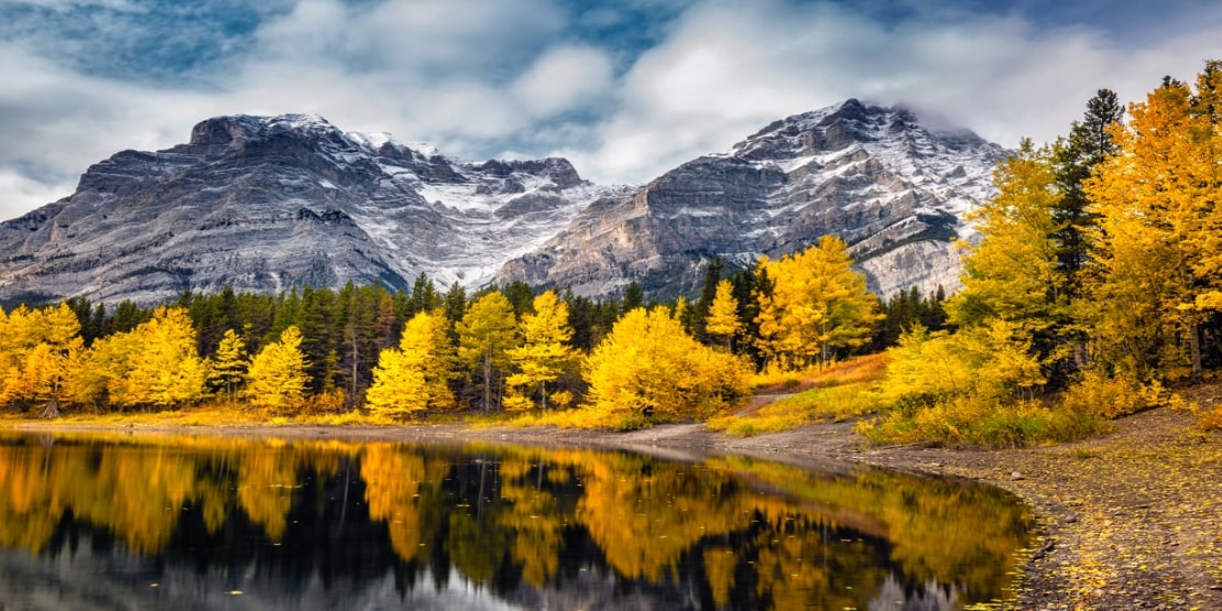
While some might think of Alberta only for its oil, forestry, minerals, and cattle farming, the landscapes of the province have a lot more to offer you. In particular, the renowned destination in Western Canada is defined by its natural beauty since it is surrounded by extensive prairies and badlands to the east, Canadian Rocky Mountains to the west and Montana (popular for Glacier National Park) to the south. Hence, this place is famous for the best hiking trails in Alberta.
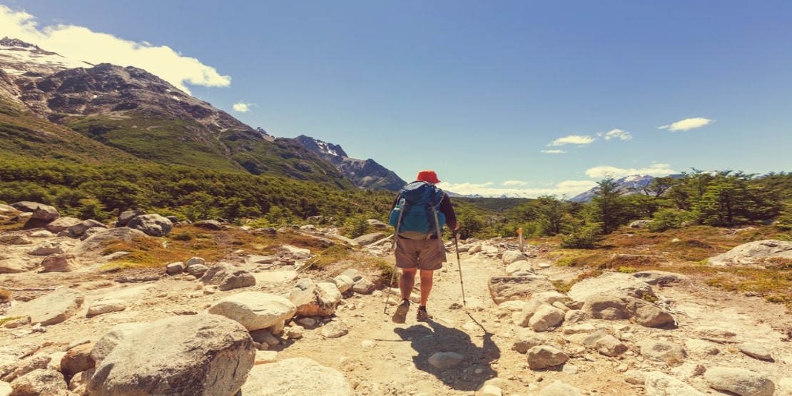
Loved for its natural beauty, Alberta turns out to be an ideal spot for thrill-seekers discovering incredible trails in the western part of the country for hiking, mountain biking and more. While searching for the best sites for hiking in Alberta, you will come across many that it is nearly impossible to untangle the endless tangle of trails.
So let’s walk down the lane to discover the 10 best hiking trails in Alberta that truly showcase the country’s abundant natural beauty.
List of 10 Best Hikes in Alberta
-
Sulphur Skyline
Length – 8 km
Elevation Gain – 700 m
Time – 4-6 hours
Closest City – Jasper
Difficulty – Difficult
It’s a short and steep climb that rewards your efforts with amazing views. At about 2 km, you can offset to Mystery Lake or opt to keep climbing to the peak. Once at the top, you will indulge in the breathtaking panoramas of Mount Drinnan, the Fiddle River Valley, Ushlar Ridge, Utopia Mountain, and the Miette Range. After this tough and tiring trek, the Miette Hot Springs will soak your sore muscles.
How to reach the Sulphur Skyline trailhead?
- Take the Yellowhead to JNP (Jasper National Park) from Edmonton.
- Follow the directions toward the Miette Hot Springs.
- Turn south from the hot spring road and follow the direction towards the Sulphur Skyline trailheads.
-
Tonquin Valley
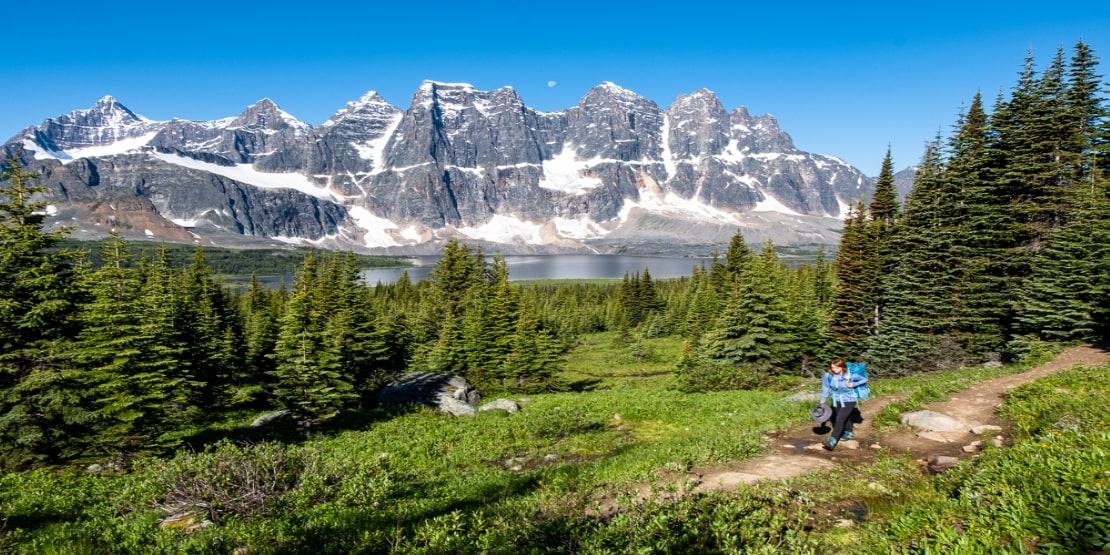
Length- 33 km
Time- 3-4 days
Closest City- Jasper
Difficulty – Moderate
It offers some incredibly scenic views that will last in the back of your mind forever. And the Amethyst lake at 20 km makes this hike a must-do for all backpackers. Since you will be heading towards grizzly country, be ready for wildlife encounters and make sure to use the bear poles.
How to reach the Tonquin Valley trailhead?
Directions to Portal Creek:
- Drive south from Jasper National Park on Highway 93 towards the Ice fields Parkway.
- Turn right up to 2 km from Highway 93A and take a right onto Marmot Road.
- Follow the directions toward the trailhead for up to 12 km.
Directions to the Astoria River: Reach the trailhead across the Edith Cavell Road, along with HI Edith Cavell Hostell.
-
Cavell Meadows

Length – 6-7 km
Elevation Gain – 500 m
Time – 3-5 hours
Closest City – Jasper
Difficulty – Difficult
Hike this beautiful trek in Alberta between July and August to enjoy the stunning views of wildflowers. Also, this lovely meadow has been discovered as major woodland caribou habitat, so it is advisable to keep your dogs at home. This beautiful, scenic grassland is a dream come true for flower lovers, along with its majestic mountains, which makes it popular amongst all the best hiking trails in Alberta.
How to reach the Cavell Meadows trailhead?
- Drive towards the south of JNP (Jasper National Park) on the Icefields Parkway.
- Turn right on 93A for up to 5.5 km.
- Take the next right on Edith Cavell Road and drive straight for 15 km to the parking at the end of the road.
Note-
– Drive slow! because the path is narrow with a lot of switchbacks and potholes.
– The Cavell Meadows road opens in June and closes by September due to snowfall.
-
Skyline Trail
Length – 44 km
Elevation Gain – 1,025 m
Time – 2-3 days
Closest City – Jasper
Difficulty – Difficult
The name Skyline Trail implies that the majority of this hike is above the treeline, which distinguishes it from other best hiking trails in Alberta. This premier backpacking trek provides the campgrounds for an overnight stay as it offers some amazing early morning views. Usually, trekkers prefer visiting this trail in July and August to avoid the snowfall.
How to reach the Skyline Trail trailhead?
– Drive towards the east on Highway 16 from Jasper.
– Take a right towards Maligne Road.
– Now drive straight to the parking lot across the bridge.
– Now follow the on-road signs to move ahead of the Skyline trailhead.
-
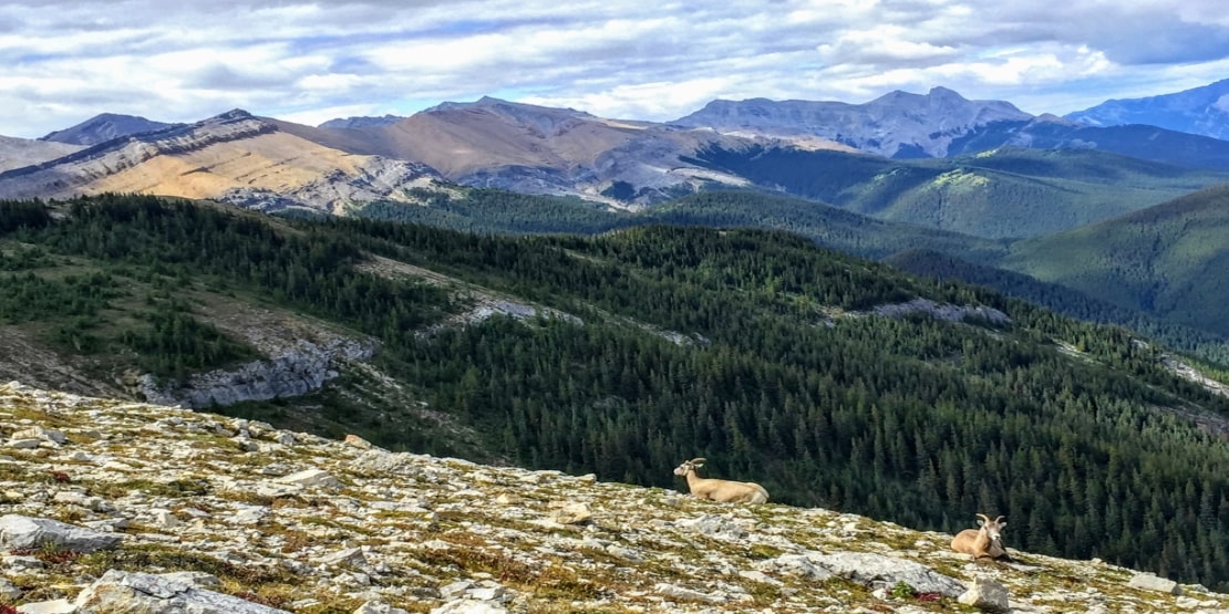
Mount Stearn
Length- 15.2 km
Elevation Gain- 1,025 m
Time- 4-6 hours
Closest City- Grande Cache
Difficulty – Difficult
If you are residing in northern Alberta, you must check out this challenging climb, which has the picturesque wildflower view to offer you. Although it offers some incredible town views from the peak, the summit trek is quite tricky for beginners, so stay alert to stay safe.
How to reach the Mount Stearn trailhead?
– Drive about 6 km north on Highway 40 from Grande Cache.
– Cross the bridge and take a left towards the Sulphur Gates Road.
– Drive straight for 3.5 km until you reach the parking lot.
-
Sunwapta Falls
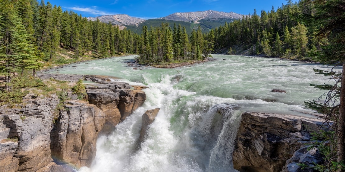
Length- 1 km
Elevation Gain- Approx 100 m
Time- 1 hour
Closest City- Jasper
Difficulty – Easy
It’s less of a trail and more of an attraction. This 18-meter tall waterfall, with its enticing surroundings, makes the place worth visiting. The waterfall falls below the parking lot, so it is advisable to stay careful in the slippery spray. In addition, you will find some tree roots crossing the trek over the waterfall. Therefore, the trail gets difficult for those with wheels or strollers.
How to reach the Sunwapta Falls trailheads?
– Drive about 55 km south of Jasper on Highway 93.
– Take a right at the Sunwapta Falls Resort.
– Drive 300 m straight to reach the parking area at the end of the road.
-
Johnson Canyon Upper and Lower Falls
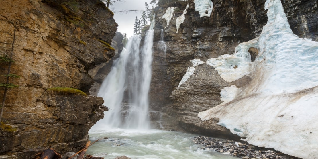
Length- 2.4-5 km
Elevation Gain- 50-120 m
Time- 1-2 hours
Closest City – Banff
Difficulty – Easy
It is comprised of two trails: the Johnson Canyon Upper Trail, which is approximately 2.5 km, and the other is the Johnson Canyon Lower Falls, which is about 1.2 km. The trail is extremely popular among visitors as it is easy to access and offers two wonderful waterfall views in a single visit.
Besides the two trails, Johnson Canyon offers different seasonal views. In the summer, the waterfalls are surrounded by wildflowers and greenery. In winter, the waterfalls freeze and bring the ice grip and poles. Other than the waterfalls, the trek also serves your adventure with the shallow pools (Ink Pots).
How to reach the Johnson Canyon trailheads?
– You can reach the Johnson Canyon area via Bow Valley Parkway/AB-1A.
– Park in the given lot.
-
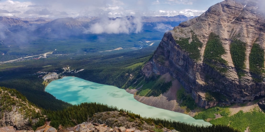
Larch Valley
Length- 8.6 km
Elevation Gain- 535 m
Time- 4-5 hours
Closest City- Banff
Difficulty- Moderate
This busy Banff National Park Hike not just serves you with a thrilling adventure experience but also treats you to an amazing meadow atop the pass, along with views of ten valley peaks. If you want to stretch your trek, then continue for about 2.5 km (200 m hike) to reach the Sentinel Pass.
How to reach the Larch Valley trailhead?
– To access the Larch Valley, you are required to approach the Moraine Lake parking.
– Take a right following the lakeshore to get the on-road Larch Valley trailhead directions.
-
Devil’s Thumb
Length- 11.9 km
Elevation Gain- 883 m
Time- 3-4 hours
Closest City- Banff
Difficulty – Difficult
From switchback turns to the panoramic view from the top, this is a tough side trek from Lake Agnes, but the trail is rewarding for sure. As soon as you reach the top of this highly-rated trail, you will witness breathtaking, expanded views. The trek might require some scrambling as well.
How to reach the Devil’s Thumb trailhead?
– Follow the shoreline path towards the trailhead from Chateau Lake Louise.
– Following the directions, you will reach Lake Agnes, where you can park in a lot for a further hike.
-
Badlands Trail
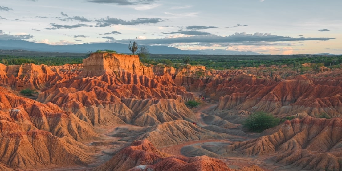
Length- 1.4 km
Elevation Gain- Minimal
Time- 30 minutes
Closest City- Brooks
Difficulty- Easy
It’s an expository loop trail that provides plenty of trek directions to help you not get confused by the area. The trek offers hoodoos, sandstone ridges, pinnacles, and especially dinosaur bones, amidst the trail.
How to reach the Badlands Trail trailhead?
– It is located approximately 48 km from the Dinosaur Provincial Park in the northeast of Brooks.
Enveloping the Adventures
Residing in Alberta, you do not need to travel the way you travel to explore; instead, explore the way you travel. There are numerous spots for hiking in Alberta, and it’s nearly impossible to visit all of them. Therefore, you must walk through the details above that have covered all sorts of interests, from the skyline, valleys and meadows to waterfalls, desert badlands and wildflower greens. While exploring these wild treats, never forget to consider their specific safety measures to make your visits more adventurous.
You May Also Read
Frequently Asked Questions:
With an elevation gain of 1,350 metres over 13.8 kilometres of distance, the Centennial Ridge in Kananaskis is rated as the hardest hike in Alberta.
Although every trail and hiker is different, on average, a normal day hike is about 8 to 15 miles a day. Even the slowest hiker can comfortably cover 10 miles a day if they hike at a pace of 2 mph (slower than the average).
As per several travel organizations, there are 2,702 hiking trails in Alberta that offer backpacking trips and mountain biking routes.
Yes, hiking every day is a healthy, routine-based activity that doesn’t just make you fit physically, but mentally as well.
There is no particular order, but here is a list of the 10 best hiking trails in Alberta:
– Tonquin Valley
– Crypt Lake
– Cavell Meadows
– Horsethief Canyon
– Skyline Trail
– Wenkchemna Pass
– The Trail of the Great Divide
– Wood Bison Trail